WORDS Gilly Gratelely
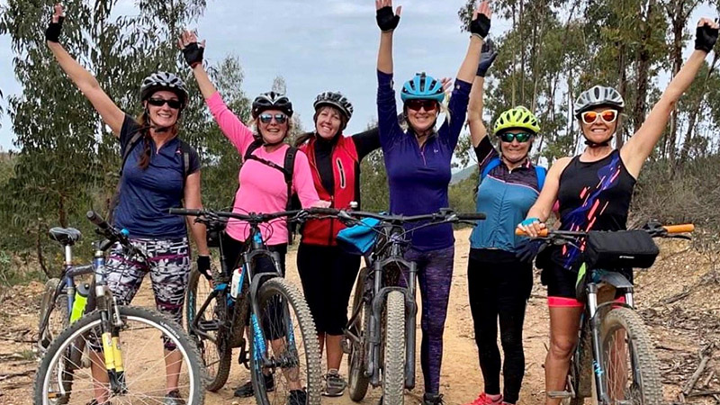
Hi, Gilly here. As previously mentioned, I regularly plan routes and love exploring new tracks and trails, so this issue I thought I would muse over how I tackle route planning. Big thanks to the reader who asked about maps and apps, I hope this will help you to find new rides.
It is great to get out on your bike and enjoy the wonderful scenery and countryside in the Algarve. If you are not currently planning your route, take it from me, studying your local area and planning ahead will enhance your experience. It helps you cater for yourself and your groups fitness levels, experience and skills, the weather conditions, the time you have available, the type of terrain you want to ride (coastal, forest, countryside etc.); you might also want to include places of interest, refreshment breaks and training goals.
Planning for me takes time, not hours, I would say 30 minutes is the norm – the more you ride the easier it gets as you become more familiar with your local area and the tools to use. I don’t create a completely new route every time I ride, I will often just interchange parts of different routes or tackle a familiar route in reverse to create a new ride. I usually have to ride a route a couple of times and tweak it before it becomes stored to memory.


I like a circular route, roughly 45kms, mainly off-road, ideally with some new tracks and a coffee stop during the second half of the ride. I usually ride out from a local meeting point, and I am not too worried about the elevation gain as from experience I know more or less what to expect in my local area.
To get started I use a local map, old school I know, but it helps provide inspiration for the general direction I am going to head out; I pick the furthest point out and then I break down the ride into sections and use a variety of local knowledge and existing routes to build up these component parts.
Local knowledge of lanes and trails and outlying villages will build quite quickly if you ride regularly. I have also built knowledge from hiking and walking my dog, and I have a riding buddy, Penny, who is pretty awesome at planning routes drawing on her knowledge of trails from horse riding. Other resources include the BTT routes we featured in January, the Atlantic Coast Route 1 from last month and the Via Algarviana as featured this month.

I piece together sections from different existing routes then bring in the tech to zoom in on the map and look for new trails and tracks. I have been using the Windy Maps app, I like the level of detail and its good off-line if you get lost or want to explore whilst out on a ride. As a side note, Windy also have a great weather app with a visualisation tool to help check out the conditions before you ride.
There are lots of useful route planning apps out there: Strava, Komoot, Map My Ride, Maps. Me, Google Maps etc. that allow you to manually plot your route and calculate distance, approximate timings, elevation gains and help identify potential refreshment stops.
Sorted, I then get out and enjoy the ride whilst recording it on my Garmin watch, which allows me to keep records of all my saved rides and analyse my stats.
Job done, not quite!
Remember I mentioned last month that I was getting to grips with a new GPS cycling computer that I had for Christmas! Well with the help of another awesome cyclist, Paul (and a few YouTube tutorials), instead of memorising my routes, I have started downloading the maps I have plotted to the computer before I ride, its great. I am also using the planning apps to search for and download different local routes posted by other riders, boom!
If you are not currently planning and varying your routes, I hope this will inspire you to give it a go and don’t forget, please get in touch and share your experiences bikinginthealgarve@gmail.com
Stay safe and have fun!


This month’s route: GR13 – Via Algarviana
I became familiar with this route through hiking, and I now regularly incorporate sections into my rides.
The Grande Rota 13 is a 300kms trail, starting in Alcoutim next to the Guadiana River, where it connects with a trans-European route in Spain; it crosses the three mountains in the Algarve, ending at Cabo de Sao Vincente.
Known locally as the Via Algarviana, the route officially opened in 2009 to help and support hiking tourism, rural development and the promotion and preservation of cultural and environmental heritage.
It is now also promoted for MBT use, although the website suggests that some sections (approximately ten per cent of the entire trail) are not suitable for riding, so you may need to get off and push or carry your bike in parts. Full details and downloads are available on the website. I have included a link below.
The trail is divided into suggested linear walks and rides, and there are an additional 12 smaller circular routes and seven routes that direct you from railway stations along the Algarve to the main trail.
The system of signs is easy to follow with two horizontal stripes, white over red for the main trail and yellow over red for the smaller trails. The signs indicate turns and dead-ends and they are not always official-looking posts. They can often be painted on rocks, walls and fence posts – now you know about them, I am sure you will spot them everywhere!


