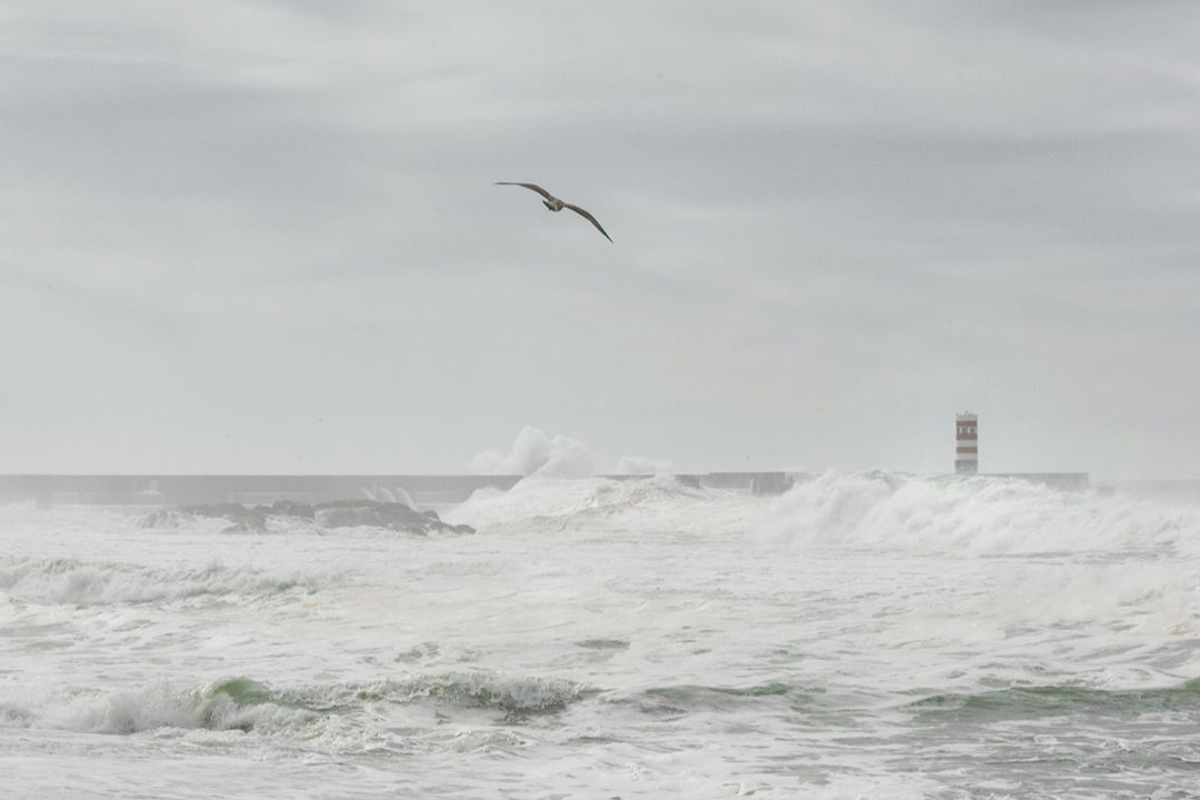
Big storms often define generations, and Portugal’s winter of 2026 will be indelibly etched on our memories.
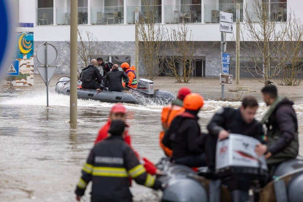
We have had bomb cyclones, sting jets, atmospheric rivers and conveyor belts of storms. “We’ve had everything,” one professor of meteorology explained. Millions of people have been affected by the high winds and intense rainfall brought by a convoy of named storms. The soil is saturated, the reservoirs are full, and river runoff meeting ocean storm surges has created catastrophic conditions countrywide.
So is this a one-off, or is it the new normal? What’s caused this extreme weather this year? How much impact is climate change having?
The answer is connected to Krakatoa, the Dust Bowl, American bombing raids to Japan during the Second World War, the first intercontinental weapon and the ‘two policemen’ responsible for sending us British weather.

The October storm and Michael Fish
But a good place to start unpacking all this is with another generational event which hit the UK – the Great October Storm of 1987. Many British readers will remember not only the 18 people killed and the 15 million trees felled by the unexpected 115 mph gusts, but also the other victim of the storm: weatherman Michael Fish.
He began the BBC’s weather forecast the day before with the famous line: “Earlier on today, apparently, a woman rang the BBC and said she heard there was a hurricane on the way. Well, if you’re watching, don’t worry, there isn’t, but having said that, actually the weather will become very windy …”
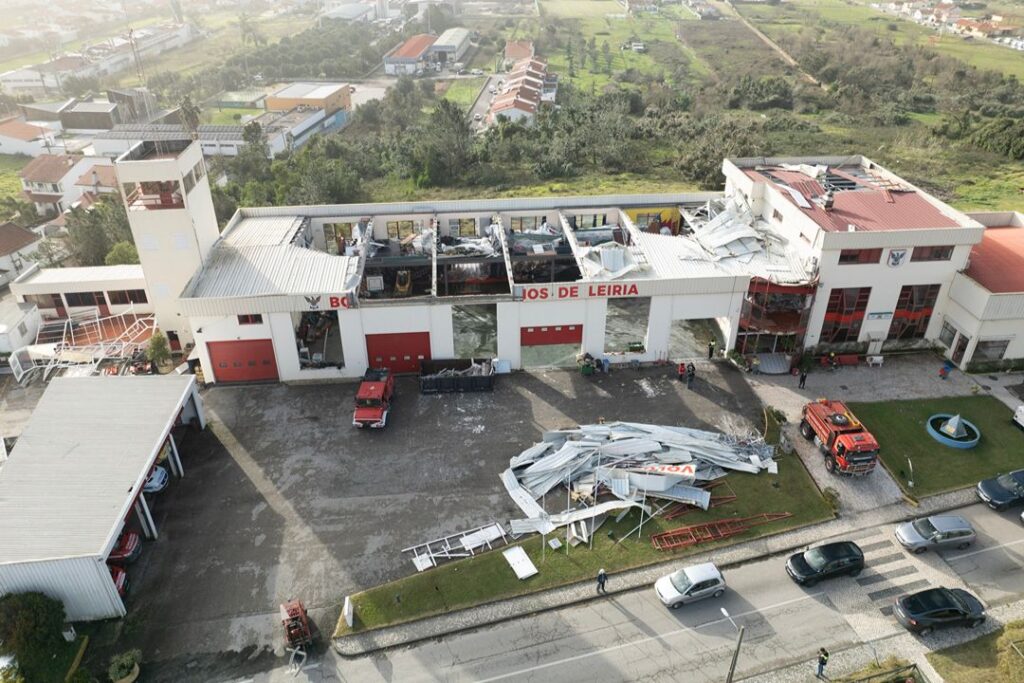
It’s a prediction which some may imagine has haunted him into his retirement, but in fact Mr Fish was right – it wasn’t a hurricane at all, but a bomb cyclone, just like Storm Kristin, complete with a phenomenon with which the people of Leiria now know all too well.
“It was a PR disaster for the Met Office and triggered a lot of research and careful analysis of the images,” said Professor Pedro Miranda from the University of Lisbon.
He explained that it was only in 2004, at the University of Reading, when researchers identified the cause of the incredibly powerful and localised wind that had originated in a part of the storm forecasters hadn’t previously expected.
Sting jets explained
They named it a ‘sting jet’ after the shape identified on satellite images, which resembled a scorpion’s tail – a powerful wind descending from a great height and lasting just a few destructive hours. The discovery enabled more accurate forecasts – notably predicting the formation of sting jets in Scotland in 2011 and 2012, when lives were saved – and it was also used in Portugal during Storm Kristin. “It was forecast by the European Centre model, but in the wrong place, so they had a different path for the storm: 90 km to the north. In these very strong systems, the path can be wrong as things can be a bit unstable,” Prof Miranda explained. “Sting jets are not very common – in Portugal, this is only the third time we have had one. The first was in 2009, then the 2013 Gong Storm and now this. Of course, we don’t know if these storms existed before [they were discovered]. But they are probably getting more frequent, because this is what we expect with climate change … stronger storms because we have more energy.”

Sting jets occur in ‘bomb cyclones’: depressions which form quickly and deepen rapidly – dropping more than 24 millibars of pressure in 24 hours to produce higher winds and intensify extra-tropical storms. Also known as ‘explosive cyclogenesis’ or ‘bombogenesis’, it’s how Kristin formed.
“You have this kind of convoy of storms which can happen now and again – these storms which come one after another and Kristin was a kind of daughter of Joseph … but this is unusual,” said Prof Miranda. “Sting jets are much less frequent than these convoys – it’s a different mechanism,” he added.
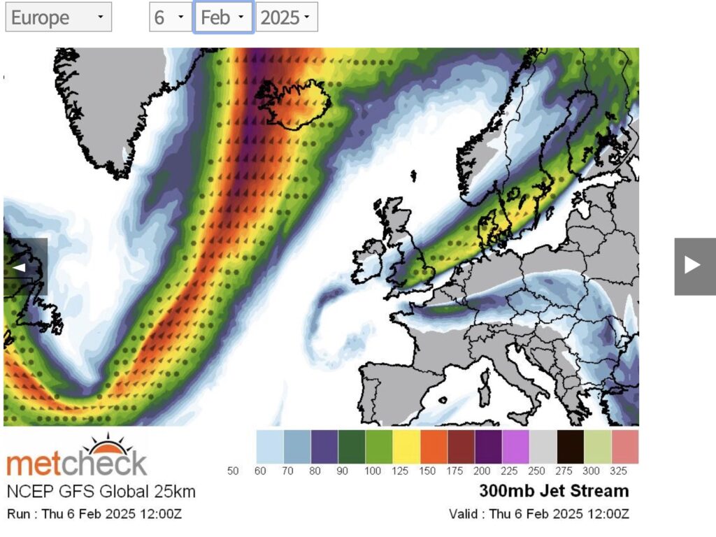
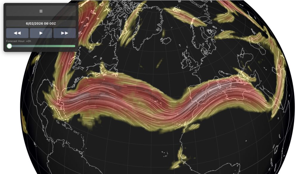
Flowing to Iberia: The path of the jet stream in early February bringing storms to Portugal – it’s usually a lot further north (Image from NetWeather’s jet stream forecasting website)
The two policemen!
The winter has been a conveyor belt of mid-latitude depressions – including the named storms of Ingrid, Joseph, Kristin, Leonardo and Marta – and this is where the policemen come in. “Two policemen regulate the traffic over the Atlantic Ocean: the Azores High and the Icelandic Low,” said Professor Carlos DaCamara, also of the University of Lisbon. He’s referring to two areas of high and low pressure, which rotate in different directions in the north and south of the Atlantic and channel all the storm systems between them like a pasta maker.
Winter weather patterns are regulated by the position and the intensity of each, and this is called the North Atlantic Oscillation. When the traffic is directed north, it brings dry weather to Portugal, but when it flows south, it brings us storms.
“This year, we have an Azores High which is further south than we would like. The traffic is going south of the UK rather than above it.” explains the professor.
It’s also weaker – a stronger Azores High sitting further north usually blocks the convoys of storms from hitting Portugal. And we have to go high up into the stratosphere to understand why the policemen are in different places this year.
The jet stream
At around 30,000 feet (9,000 m), a fast-flowing jet of air, a few hundred kilometres wide, flows west to east like a river of air running fast and straight at up to 250 mph (400 km/h), or meandering more slowly and shaping European winter weather.
Pilots use the jet stream like a travelator to fly from the US to Europe, saving fuel and time … and then try to avoid its headwinds altogether on the way back. It’s created as heat from the sun which has hit the equator flowing towards the colder poles in search of equilibrium and is pulled east by the Earth’s rotation. It speeds up where the warm tropical air meets the icy polar blast.
“The jet stream is like a river and has meanders. Sometimes, with strong meanders towards the south, it creates the conditions for these weather systems to go further south rather than into the UK and over Denmark,” explained Professor DaCamara. “The path north is blocked by high pressure and you get a train of depressions all following the same path.”
There’s another tighter stream of wind circling much higher above the Arctic during the winter known as the polar vortex. If it weakens, slows and meanders, it has a knock-on effect on the jet stream and brings icy weather to parts of North America and northern Europe.
This year the policemen are being dragged further south, bringing icy temperatures to northern Europe, dividing North America between warm and cold across the middle and bringing more storms to Iberia.
And what’s more, “the Atlantic is unusually warm, which means more water vapour – which is a source of energy,” said Prof DaCamara, explaining that the impact of an ‘atmospheric river’ flowing from the Caribbean is fuelling the conveyor belt of storms.
“Climate change is increasing the probability of having extreme events. Is this winter caused by climate change? No – it is part of the normal balance related to the jet stream,” he said. “But 99% of climatologists have observed an increase in the frequency of extreme events in the last decades – increased frequency, severity and over a wider area.” He used the example of a winding road where accidents can happen more frequently if “the roads are wet and the tyres are bad.”
“Climate change is degrading the road – it has more potholes and structural changes.” And of Portugal’s stormy winter of ’26 with its bomb cyclones and sting jets: “This situation is very, very, very unusual. If this had happened 50 or a hundred years ago, when there were no dams to fill it would have been a total disaster. Climate change is expected to increase the probability of such events.”
And is the rain done yet? Professor Pedro Miranda gets the last word on forecasting. “It works quite well for one week ahead, for two weeks it’s probably less reliable, but anything after that is less predictable.”
As the well-known Portuguese saying “Em Abril, águas mil” (in April, a thousand waters) warns, there could be more to come before the winter of ’26 is finished with us.
Alastair Leithead is a former BBC foreign correspondent now living in Odemira, Alentejo, where he and his Portuguese/Swedish wife Ana have built a fully off-grid eco-luxe resort called Vale das Estrelas or Valley of the Stars.
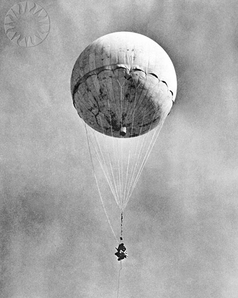
The jet stream and Fu-Go balloon bombs
In the early 1800s, an American scientist first began to theorise about a high-level river of air circulating around the globe.
It was first noticed by weather watchers after the 1883 eruption of Krakatoa created an ‘equatorial smoke stream’. Experiments by a Japanese scientist proved its presence, and its meanders probably caused the Dust Bowl drought of the American Midwest. But it wasn’t until the Second World War that the powerful west-to-east ’jet stream’ started being taken seriously.
American aircraft flying high-level bombing raids to Japan would sometimes make slow progress, or even run out of fuel battling unseen headwinds, but Japanese explosive-laden hydrogen-filled paper balloons would make fast progress when they were launched towards America.
Around 9,300 Fu-Go balloon bombs were sent across the Pacific with the intention of starting forest fires and creating panic. They were the world’s first intercontinental weapons. Three hundred were recorded landing in the US, Canada and Mexico, but they had little impact other than on one occasion in May 1945 when six civilians were killed in Oregon.
After the war, the research continued and, in 1952, Pan Am Airlines used the jet stream to reduce the flying time from Tokyo to Honolulu by more than a third.
Today, it’s an important part of trans-Atlantic flights: pilots enter the stream to save both fuel and time heading east, and avoid it when flying the other way.
Blue sky thinkers believe the jet stream might be used for power generation, once scientists work out how to keep an aerostatic wing static at 30,000 feet … and to get the electricity back down to earth.
(There’s a great episode of the wonderful Radiolab podcast all about Fu-Go balloon bombs.)