If you do your weekly shop at Pingo Doce in Lagos, you will probably be unaware that the mound facing you has been identified as the most likely site for Lacobriga, a settlement previously referenced by the Roman geographer Pompónio Mela in the year 45AD. Tomorrow sent Julian Putley on a fascinating journey to Monte Molião and a trip back to the Iron Age.
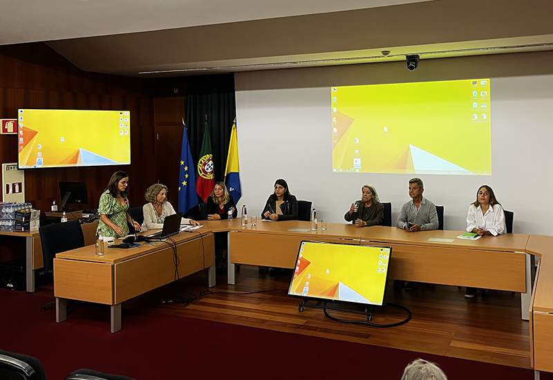
The 9th Jornada do Monte Molião, on 23 September, started at the Câmara de Lagos and continued to the site of the ancient village. The event was a collaboration between the Universidade Autónoma de Madrid and the Câmara de Lagos. The exposition was divided into four segments: an overview, the progression of studies at the archaeological site, ceramics and artefacts, and archaeological architecture. Heading the discussion was renowned archaeologist Margarida Arruda, a Professor at the Faculty of Arts in Lisbon.
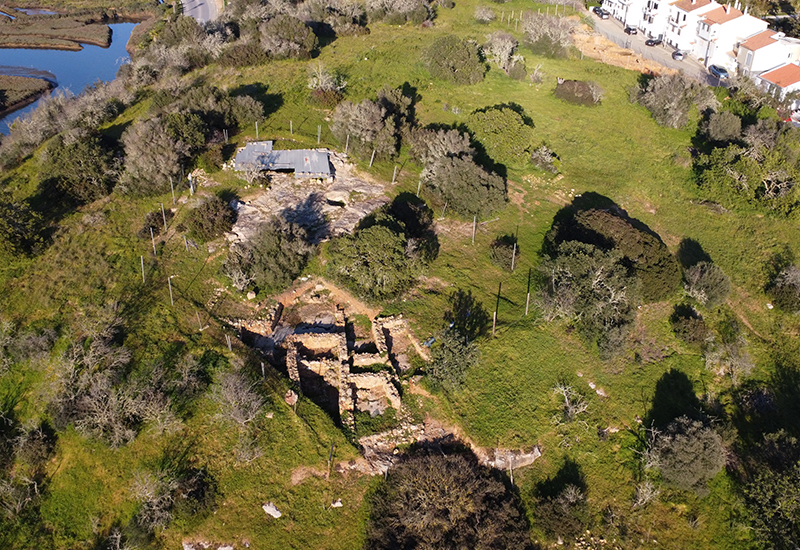
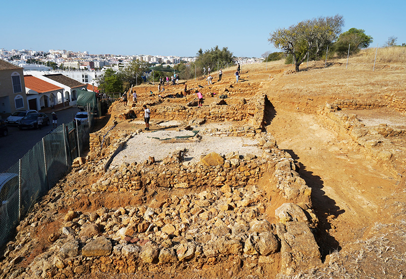
Professor Arruda explained that the site where Monte Molião stands was a fortified settlement about 30 metres in elevation and built during the second Iron Age, at the end of the 4th century BC. There is evidence of increased activity during the Roman period ending at the end of the 2nd century AD. The settlement lost its importance when the nucleus of (now modern-day) Lagos moved to the other side of the Bensafrim River, which had a wide estuary at that time.
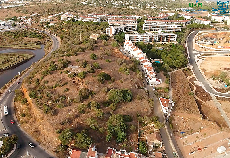
Due to its height and position, Monte Molião was probably chosen because it was ideally situated for defence and enabled the surveillance of adjacent territory, including the coast of Lagos. Its location close to the estuary was good for fishing and the use of river and sea resources.
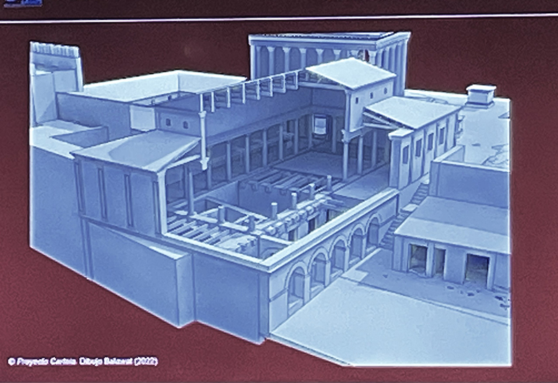
In its early years, the settlement must have been of considerable size, with typical characteristics of Mediterranean urbanism and architecture. This connection is explained by the ceramic pieces collected from the city of Cadiz and the Mediterranean region, once again revealing that the settlement of Monte Molião was part of the commercial routes of the day.
A site visit in the afternoon was conducted by Professor Elisa de Sousa with explanations on how various walls were built, how they were either replaced or rebuilt, their purpose and how the footprint left to us today can help identify the town as it was centuries ago.
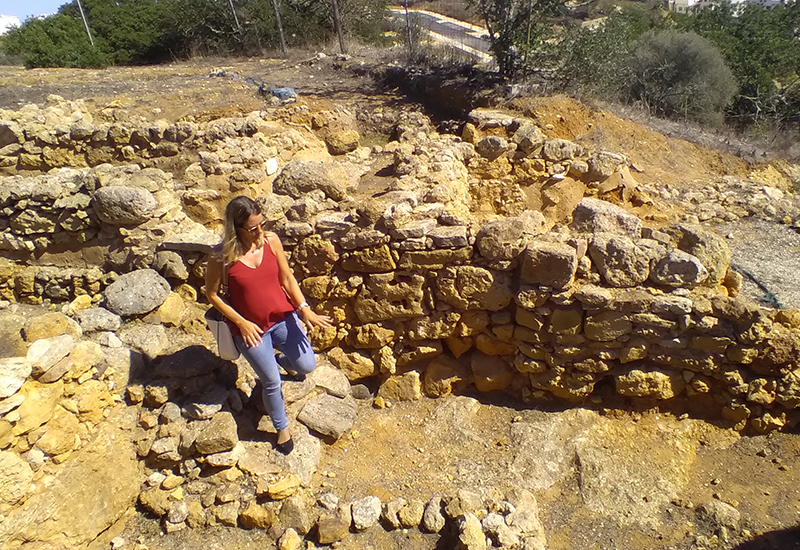
Since 2006, exploration and examination of the site have seen increased activity, with students of archaeology becoming involved and learning the importance of the science of uncovering historical clues. Professor Elisa de Sousa explained how building materials and construction methods can identify different time periods of construction from the Second Iron Age to the Roman era. She identified the uses of rooms and their access points and how changes were made at different times over the centuries. One of the main structures at the archaeological site is a cistern approximately 4m deep, 2m wide and 7m long. At present, it is covered with corrugated tin for safety and preservation.
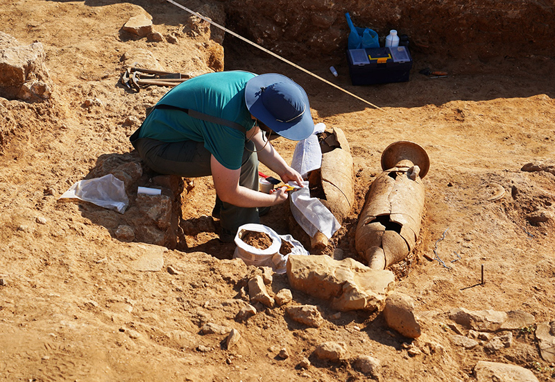
Researcher Margarida Rodrigues’ expertise is in the collection and identification of artefacts, including ceramics, metal objects and fragments, which add to the story of Monte Molião. The archaeological site has revealed a wealth of important information in terms of assets, with around 25 thousand pieces recorded and roughly a few hundred thousand still left to be registered.
Previous excavations have unearthed historically important artefacts. At the end of the 19th century, Portuguese archaeologist Estácio da Veiga discovered two gold earrings (4th century), republican coins and a perfect statuette of the God of Mercury from the Roman Period (2nd century AD), now in the National Archaeology Museum in Lisbon.
The importance of artefacts cannot be underestimated. Ceramics like earthenware, bowls, and amphoras are usually stamped by the maker and these stamps provide answers as to their origin and time-line of manufacture. At the site, samples from Asia, Greece, Italy and North Africa have been identified and the archaeologists can now ascertain that there must have been trade routes through the area.
Two eminent speakers from the University of Madrid, Lourdes Roldán and Juan Blánques, gave long lectures on the ancient architecture and urbanisation that can be discerned from archaeological sites. A new technology called photogrammetry can now measure distances, capture colour information, and identify periods of construction. Photogrammetric processing of digital images can also generate 3D data. Archaeology, by its very nature, requires the disturbance of sites, so photogrammetry is a huge step forward.
The whole site was declared a Property of Public Interest in 1992. It is of huge interest in terms of educating younger generations and an attraction to residents and visitors alike. Workshops and archaeological/history training for students already take place at the site. An interpretation centre is planned for location at the Monte Molião site in the near future.
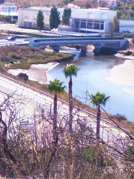
Photograph looking down from Monte Molião shows the vehicular bridge that crosses the Bensafrim River. It was built on the ruins of a Roman bridge. In Roman times, the estuary of the Bensafrim river was wide and navigable in places. Before urbanisation, the Praça de Infante was a protected anchorage and fishing was a major industry, with the famous and much beloved fish sauce, garum, being produced and even exported back to Rome.
The archaeological site can be seen looking east from N125 near the Pingo Doce supermarket. It’s on the side of the hill, but access is restricted by a fence. It is open to the public at various times and announcements are made in the local media.